
Page 1
Ancient history
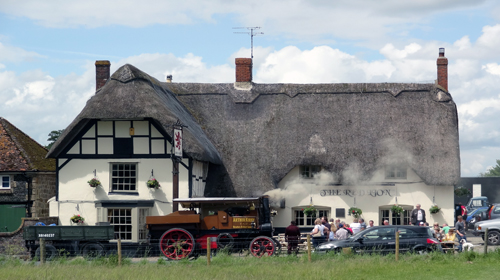
Surroundings
Avebury is located in South West England. Situated approximately 32 kilometres (20 miles) north of Stonehenge, 17 kilometres (10.5 miles) south west of Swindon, Avebury is a picturesque little village built on an ancient earth mound known as a henge. The henge is basically a large circular embankment up to 5.5 metres (18 ft) in height, with an adjacent surrounding ditch. The ditch was originally dug to a depth of 9 metres (30 ft) and was about 21 metres (69 ft) wide. Upon the henge and at some later time, three stone circles were erected. There was one large circle of huge sarsen stones and two inner circles. The village was later built on top and around the henge.
The stone circles were constructed over generations and remains the largest Neolithic site in the country.
To the north west of Avebury is Windmill Hill. This ancient site predates Avebury and was the original settlement site dating from 3700 B.C. Concentric rings indicate former hut foundations, pottery and animal bones excavated there indicate a former flourishing settlement.
There was originally two stone avenues south of Avebury, one known today as the Beckhampton Avenue, which sadly no longer exists, but is identified from 17th century maps. The other avenue known as the West Kennet Avenue and lined by smaller stones on each side, used to run from the henge to another ancient site known as the Sanctuary at Overton Hill, about four kilometres (2.5 miles) away. Today only a third of the avenue exist.
Many of the stones which make up the circles are missing. This was attributed to possibly the Romans when they conquered Britain and the attitudes of the church through medieval times. The church did not approve of paganism which the Neolithic people practised, so advised the village people to remove as many stones as possible. This was achieved in two ways, either toppling the stones and applying straw to heat the stones and then water to break them up, the other way was to simply bury them. This is the reason why only a third of West Kennet Avenue remains.
The Avebury was mentioned in Samuel Pepy's diary in 1668 where he likened it to the building at Stonehenge.
Alexander Keiller (1889-1955) used his wealth to purchased the site in the 1930s. He spent many years excavating and restoring the site, and is responsible for what we can see today. In 1943 he sold the site to the National Trust, knowing it would be looked after.
Silbury Hill and West Kennet Barrow
Mysteries
Silbury Hill is about two and a half kilometres (1.5 miles) south of Avebury and is an ancient mound which today still holds it secret of why it was built. It remains the largest man made mound in Europe and was once believed built in three phases from about 2400 B.C. Other experts place the start of construction at least a hundred years earlier at 2500 B.C. In June 2007 and in 2008 Dr. Jim Leary from Reading University directed major excavations into Silbury Hill. He contradicts the wide held view that the hill was built in three phases. Instead, he suggests it was built by generations of people and possibly visitors wanting to settle in the region, bringing offerings of earth in baskets from their own home areas, while visiting Swallow Head Spring. The latest results from radiocarbon dating places the construction of the hill somewhere in the region of 2400 B.C and 2500 B.C. Dr. Leary speculates that the nearby Swallow Head Spring, a life giving source of water in the Neolithic era was the motive to both worship its sacred water, and in turn, to deposit soil material from their baskets onto the hill. He believes the hill was built by the efforts of several generations of people, and taking 100-150 years to complete. Silbury Hill eventually reached 39.6 metres (130 feet) in height.
West Kennet Barrow was thought to be an ancient Neolithic burial tomb, and religious center, lying approximately four kilometres (2.5 miles) south from Avebury, and might date from as early as 3500 B.C.
A walk around the henge
North West Quadrant
This area can be reached by following the sign post in High Street and walking towards the National Trust Shop, but veering away from the building and right to the wooden steps. Access to the henge is through a platform of wooden steps and a gate.
You will find 12 sarsen stones in this quadrant, the largest being the last one known as the Swindon Stone (about 65 tonnes) which is diamond shaped and dating from 2500 B.C. It was given this name because it is next to the road which runs to Swindon. Several stones in this quadrant are missing, but are marked with concrete posts. If you walk close to the embankment, you can see the steep ditch, so be careful with your footing.
From the Swindon Stone, follow the fenced footpath until you can crossover the road to the North East Quadrant.
North East Quadrant
Few stones are visible in this quadrant. Some might have been taken for local buildings, while others could still be buried. A National Trust survey indicated that as many as 15 stones are lying underground.
This quadrant originally contained the northern inner smaller circle of stones. There were originally three large sarsen stones the centre of this circle, and set at 60 degrees apart with one area left open to enter into. This formed the Cove; today only two stones remain, known as the Adam and Eve.
From the Cove cross the quadrant to the furthest eastern edge where you can cross the the road through wooden gates to the South East Quadrant.
South East Quadrant
You are on top of the embankment, so unable to walk directly to the centre of the quadrant because of the ditch in front of you. Instead follow the embankment around and drop down to the quadrant from wooden steps erected at the southernmost point. One notorious stone in front of you now is known as the Devil's Chair.
There are many sarsen stones in this quadrant and most notably those forming the remains of the southern inner circle. At the centre of this circle was a very large stone known as the Obelisk, but broken-up in the medieval ages and taken away for building stones. Only a concrete marker remains.
From the inner ring walk westward to the road where you can crossover into the South West Quadrant.
South West Quadrant
There are 11 sarsen stones visible here, from the southernmost point the sixth stone is known as the Barber's Stone, and named after an unfortunate accident resulting in the death of a man through being crushed by the stone in the 17th Century. Follow the stones around until you locate the first, known as the Blacksmith's Stone from being reassembled from fragments located in Blacksmith's forge.
Walk through the gate leading to High Street and crossover the road. This time you can visit the National Trust Shop, have a meal at the barn restaurant, visit the Keiller Museum, or visit the Manor House recently refurbished through the BBC series "The Manor Reborn" with Penelope Keith.